From ideas to creating, writing to editing, it's worth everything when I see my blog. It's been a year I created it, where I turned my passion for the ocean into a stream of words. Happy 1st birthday my baby blog.
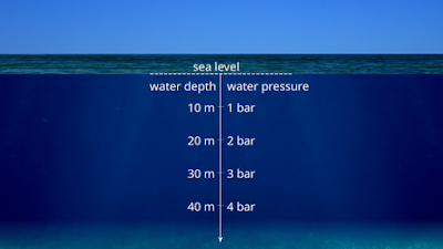
At sea level, the air that surrounds down presses down at 14.7 pounds per square inch. We don't feel it, because the body releases the same force pushed by the fluids in our body. Dive deep into the ocean, you will encounter a noticeable change. You can feel an increase in pressure at your eardrums. This is due to the increase in hydrostatic pressure, the pressure exerted by a fluid on an immersed object. The deeper you go, the increase the pressure pushes you down. For every 33 feet, you dive deep, there is a change in the atmosphere by 1 unit. The animals living deep, are experienced to live extreme pressure conditions. They have special features which help them to deal with these tough conditions. In the deepest part of the Atlantic, the pressure can reach up to 840 bars while the pressure at the challenger deep ( Mariana Trench ) can go up to 1000 bars or more. Whales, deep dive to almost 2000 meters to capture the squid. They breathe air, but their lungs are collapsible, so t...
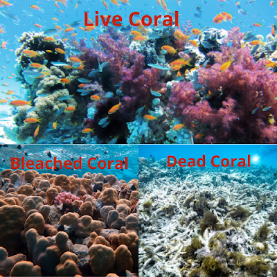
Beneath the surface, the ocean is teemed with lot of life rather than any other biodiversity. Corals are the main reason and primary source of life for countless animals. But these reefs have been reached an endangered state because of the human activities. Most of the corals have been wiped out due to pollution, unrealistic fishing activities and climate change. Due to warm water temperatures, corals reach to a stress sate which results in releasing the algae present in their tissues which makes the coral white. This is referred as coral bleaching, but that doesn't mean the coral is dead. A coral can survive a bleaching event, but if the water warms more it results in the dead of the coral. In 2005, most of the corals have been died due to extreme bleaching event. This thermal stress is much greater than compared in all the 20 years. Not only warm waters, even cold waters can result to bleaching. In 2010, cool waters in Florida have been made some serious damage to the coral which...
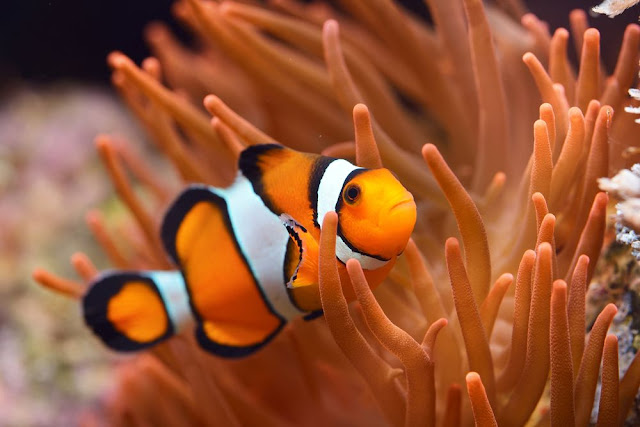
Damn, who doesn't know about this little character, popularly known for the films "Finding Nemo" and "Finding Dory" which made people easily identify it. The real name of this orange and white color creature is clownfish and some individuals also resemble dark black and white in color. There are at least 30 clownfish species, most of them live in the shallow waters of the Indian Ocean, Red Sea, and the Western Pacific. Like all other clownfish, they spend most of their life feeding on the tentacles of their host anemone. They feed themselves on zooplankton and phytoplankton floating on the water column. Sometimes, they also prefer to eat algae present on the reef structure. What makes them more interesting? We all know specific animals change their sex to meet the demands of their life. Usually, they change from female to male, but the clownfishes can change from male to female. They hatch as males and join the individual groups on the anemone...
Comments