First Map of World's Coral Reefs
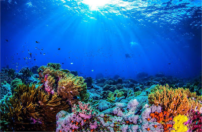
Scientists have completed the first map of the world's coral reefs to monitor and conserve an ecosystem that facing the threat of destruction by human activities and climate change.
The Paul Allen Atlas combines over 2 million images using the local reference data to create a high-resolution map of coral reefs.
The map provides a better way to understand and protect increasingly threatened coral reefs. Nearly 98000 square miles of coral reefs have been mapped up to the depth of 50 meters. It also collects data about the seafloor and ocean that interacts with the coral reefs, including wave turbidity and the presence of rocks and sand.
“There are countries, organizations and government agencies in the world that don’t have a map of their reefs […] so these maps will help people by basically giving a baseline to better assess where the action is needed,” says marine scientist Chris Roelfsema, who led the mapping process for the Allen Coral Atlas, to Mongabay. “We can better make plans for marine protected areas, or we can extrapolate fish biomass or look at carbon stocks and all those kinds of things that up until now were not possible.”
The atlas is named after Paul Allen, a co-founder of Microsoft who funded the partnership behind the project, which involved more than 450 research teams around the world, per Mongabay.
Even though only 1% of the ocean bed is coral reefs, there are million species that rely on these reefs. After surviving and living for thousands of years, climate change is putting great pressure on these ecosystems. Increasing temperatures and ocean acidification is destroying them, more than half of the reefs have also been destroyed, including the Great Barrier Reef.
The scientists behind the map say that it will help the world better understand the reefs and save them from the impacts of our climate crisis and other threats.


Comments